Traffic used to be something drivers reacted to after the fact. You got stuck in a jam, listened to a radio update that arrived ten minutes too late, and hoped the next route would be better. That experience has changed dramatically over the last two decades. Today, vehicles, smartphones, satellites, cameras, and roadside sensors work together in ways most people never notice, quietly shaping the routes we take every day.
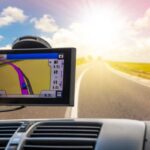
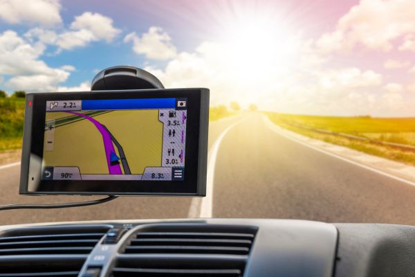
At the center of that transformation are real-time traffic data systems. These systems collect, process, and distribute live traffic information almost instantly, helping navigation tools respond to changing road conditions with surprising speed. Whether it is a commuter avoiding an accident on a highway or a logistics company rerouting delivery trucks around a construction zone, the modern transportation experience depends heavily on live data flowing through digital networks.
The technology behind it is more layered than many people realize. It is not simply about maps updating on a phone screen. Real-time traffic data systems are part of a much broader telematics ecosystem involving communication infrastructure, predictive analytics, connected vehicles, and large-scale urban traffic management.
Understanding How Real-time Traffic Data Systems Work
At a basic level, these systems gather information about vehicle movement and road conditions, then turn that information into usable guidance. The challenge lies in doing this continuously and accurately while conditions are changing minute by minute.
Traffic information comes from multiple sources at once. GPS signals from smartphones and vehicles provide anonymous speed and movement patterns. Roadside cameras monitor congestion levels and incidents. Embedded road sensors track vehicle counts and lane occupancy. Public transit feeds, weather systems, and emergency services also contribute valuable context.
Once the data is collected, it moves into processing platforms that analyze traffic flow in real time. Algorithms compare live conditions against historical patterns to identify abnormalities. If average speed on a highway suddenly drops, the system may recognize a collision, lane closure, or bottleneck before authorities formally report it.
The processed information is then distributed to navigation apps, traffic management centers, fleet systems, and digital signage. Drivers see alternate routes appear on their screens almost immediately. Traffic control agencies may adjust signal timing to reduce congestion in affected areas.
The speed of this cycle is what makes the system effective. In busy metropolitan areas, even a delay of a few minutes can reduce the usefulness of the information.
The Evolution From Static Maps to Dynamic Navigation
Older navigation systems were largely static. Early in-car GPS devices relied on preloaded maps stored on discs or memory cards. They could calculate directions, but they had no awareness of what was happening on the road in the moment.
That changed as mobile internet connectivity became widespread. Smartphones introduced constant network access, allowing mapping platforms to update conditions continuously instead of relying on scheduled updates.
The shift was significant because roads are highly unpredictable environments. A route that looks efficient at 8:00 a.m. may become unusable at 8:20 due to an accident or weather event. Real-time traffic data systems brought adaptability into navigation.
Modern systems now combine live traffic feeds with predictive modeling. Instead of simply reacting to congestion, some platforms attempt to forecast where traffic will worsen over the next hour. This predictive layer is becoming increasingly important in urban planning and large-scale transportation management.
Sensors, Cameras, and Connected Infrastructure
Much of the public associates traffic monitoring with smartphone apps, but the physical infrastructure behind these systems remains essential.
Roadside sensors still play a major role in traffic detection. Inductive loop sensors embedded in pavement can measure vehicle speed and density. Radar-based monitoring systems track movement without requiring physical installation inside roads. In some cities, AI-powered cameras analyze intersections to estimate congestion and identify unusual driving behavior.
Smart traffic lights are another growing component. Instead of operating on fixed schedules, adaptive signal systems respond to actual traffic conditions. If one direction becomes heavily congested, signal timing can shift dynamically to improve flow.
In highly connected urban environments, these components communicate with centralized traffic management centers. Operators monitor citywide movement patterns and respond to incidents with a level of visibility that was almost impossible a generation ago.
This integration is often described as part of a “smart city” approach, though the reality is usually less futuristic than the term suggests. Most cities are still gradually modernizing older infrastructure while layering new digital tools on top.
The Role of Crowdsourced Traffic Data
One of the biggest breakthroughs in real-time traffic data systems came from crowdsourcing. Instead of relying solely on government-installed sensors, traffic platforms began using anonymous location data from everyday drivers.
When thousands of vehicles on the same road suddenly slow down, the system recognizes congestion almost instantly. In effect, every connected device becomes a moving traffic sensor.
This approach dramatically increased coverage. Traditional monitoring infrastructure is expensive and often limited to major highways or urban corridors. Crowdsourced data extends visibility to smaller roads, suburban streets, and rural routes where dedicated monitoring equipment may not exist.
The scale of participation matters enormously. The more connected users a platform has, the more accurate its traffic insights become. This network effect is one reason navigation ecosystems evolved so quickly once smartphone adoption accelerated globally.
At the same time, crowdsourced systems introduced new debates around privacy. Anonymous location tracking raised questions about how mobility data should be collected, stored, and shared. Most modern platforms emphasize aggregation and anonymization, though public concern about digital tracking continues to shape regulatory discussions.
Real-time Traffic Systems in Commercial Transportation
For commercial transportation and logistics, traffic data is not merely convenient. It directly affects operational costs and efficiency.
Fleet operators use telematics platforms to monitor vehicles continuously, optimize delivery routes, and reduce idle time. Delays caused by congestion can increase fuel consumption, disrupt schedules, and reduce overall productivity.
Real-time traffic systems help dispatchers make quick adjustments during active operations. If a major highway becomes blocked, vehicles can be rerouted immediately instead of sitting in traffic for extended periods.
Long-haul trucking companies increasingly integrate live traffic intelligence with fuel management systems, driver behavior monitoring, and predictive maintenance tools. The result is a broader operational picture rather than a simple navigation function.
Public transportation systems also rely heavily on live traffic monitoring. Bus networks, in particular, use real-time positioning and traffic analysis to improve scheduling accuracy and passenger information systems.
In many cities, commuters now expect live arrival estimates because traffic-aware systems have become so common. That expectation barely existed twenty years ago.
Weather, Emergencies, and Traffic Intelligence
Traffic conditions rarely exist in isolation. Weather, construction activity, public events, and emergencies all shape road behavior in complex ways.
Advanced traffic data systems increasingly combine environmental information with transportation analytics. Heavy rain, snow, fog, or flooding can alter routing recommendations automatically. During major storms, traffic management agencies may coordinate with emergency services to redirect vehicles away from hazardous zones.
Large public gatherings create another challenge. Concerts, sporting events, and festivals can produce temporary traffic surges that overwhelm normal road capacity. Real-time systems help cities prepare by analyzing historical event data alongside live traffic conditions.
Emergency response coordination has also improved significantly. Faster detection of accidents allows authorities to respond sooner, while traffic management platforms can assist in clearing routes for emergency vehicles.
These capabilities highlight an important point: real-time traffic data systems are no longer isolated navigation tools. They are increasingly part of broader public infrastructure networks.
Artificial Intelligence and Predictive Traffic Modeling
Artificial intelligence is beginning to reshape traffic analysis in more sophisticated ways. Traditional systems focused mainly on current conditions, but AI models can identify patterns humans would struggle to detect manually.
Machine learning systems analyze enormous datasets containing weather patterns, traffic flow history, commuter behavior, and road incident records. Over time, they learn how congestion forms and spreads across transportation networks.
This predictive capability matters because traffic often behaves like a chain reaction. A minor slowdown in one location can ripple outward across an entire city. Predictive modeling attempts to anticipate those ripple effects before they fully develop.
Some researchers are also exploring vehicle-to-infrastructure communication, where connected cars exchange information directly with roads, signals, and traffic systems. In theory, this could create far more responsive transportation networks in the future.
Autonomous vehicle development depends heavily on this type of real-time environmental awareness. Self-driving systems require continuous data exchange to navigate safely and efficiently.
Still, widespread adoption of fully connected transportation systems faces technical, regulatory, and infrastructure challenges that are unlikely to disappear quickly.
The Human Side of Traffic Technology
Despite all the technical sophistication involved, real-time traffic systems ultimately exist because people dislike uncertainty. Drivers want predictability. Cities want smoother mobility. Businesses want reliable transportation schedules.
Yet there is an interesting paradox within these systems. When navigation platforms reroute large numbers of drivers simultaneously, they can unintentionally create congestion on roads that were previously quiet. Some neighborhoods have experienced noticeable traffic increases because routing algorithms identified shortcuts through residential areas.
This reveals how transportation systems are deeply interconnected. Solving congestion in one location can shift pressure somewhere else. Technology helps manage traffic, but it cannot eliminate the physical limitations of roads and urban design.
Human behavior also remains difficult to predict completely. Drivers do not always follow recommendations. Weather changes suddenly. Construction projects run late. Cities evolve faster than infrastructure sometimes can.
For all their accuracy and sophistication, traffic data systems still operate within a constantly changing environment shaped by millions of individual decisions every day.
Conclusion
Real-time traffic data systems have quietly become one of the most influential technologies in modern transportation. They shape daily commutes, support logistics networks, improve emergency response coordination, and help cities manage increasingly complex mobility demands.
What began as simple digital navigation has evolved into a vast ecosystem of sensors, telematics platforms, predictive analytics, and connected infrastructure. These systems now influence how vehicles move through cities in ways that most drivers barely notice until a route suddenly changes on a screen.
As transportation networks continue to grow more connected, the role of live traffic intelligence will likely expand even further. Artificial intelligence, smart infrastructure, and connected vehicles are already pushing the technology beyond basic navigation into broader urban mobility planning.
Even so, traffic remains deeply human. Roads reflect the rhythms, habits, frustrations, and unpredictability of everyday life. Real-time traffic data systems may not remove congestion entirely, but they have fundamentally changed how people understand and respond to the movement of modern cities.